| : Ordnance Survey Benchmarks that can be observed along : | the Cotswold Canals |
< other canal Benchmarks for copy/paste |
|
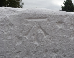
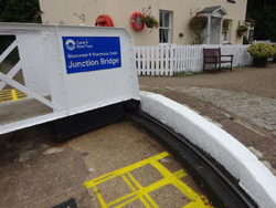
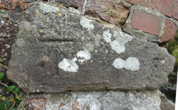
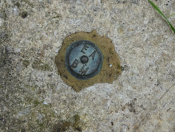
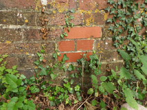
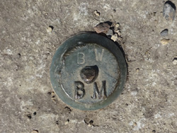
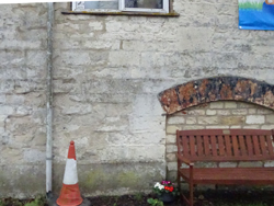
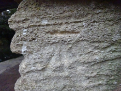
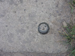
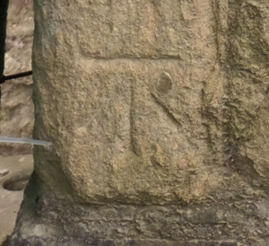
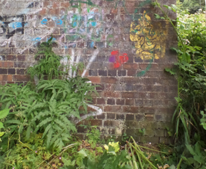
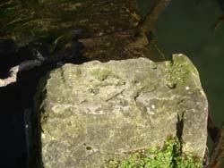
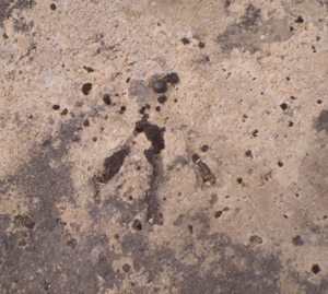
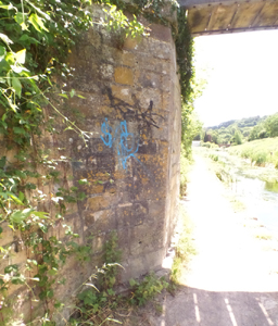
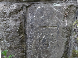
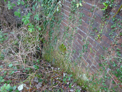
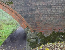
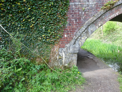
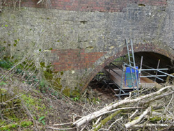
| bridge ramp, Saul Junction |
| ( 10.9M above sea level) | |
| streetmap of SO 7564 0930 or | |
| what3words /// farmer.emeralds.commuted | |
| click image to enlarge |
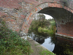
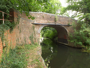
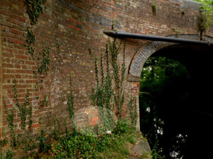
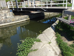
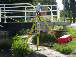
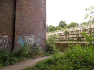
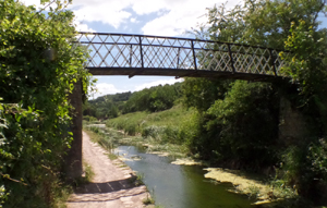
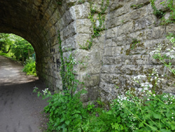
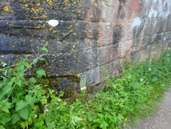
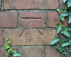 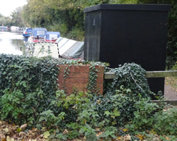 | Walk Bridge, Stroudwater, Saul |
| ( 11.7M above sea level) | |
| streetmap of SO 7582 0892 or | |
| what3words /// indulges.pretty.clasps | |
| click image to enlarge |
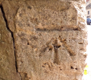
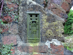
  | Occupation Bridge, Whitminster |
| ( 11.4M above sea level) | |
| streetmap of SO 7702 0787 or | |
| what3words /// builds.started.mountains | |
| click image to enlarge |
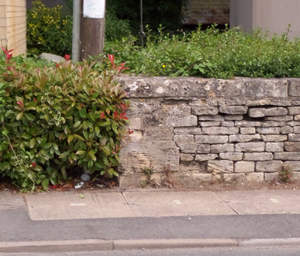
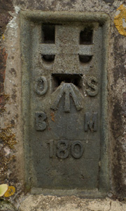   | Westfield Bridge |
| ( 16.0M above sea level) (FL BR 180) | |
| streetmap of SO 7802 0623 or | |
| what3words /// custodian.workbook.excavate | |
| click image to enlarge |
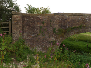
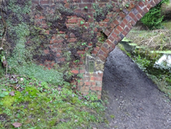
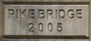 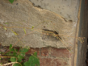 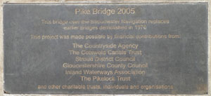 | Pike Bridge, Chipmans Platt |
| ( 23.0M above sea level) (FL BR 179 destroyed) | |
| streetmap of SO 7836 0608 or | |
| what3words /// rummage.powering.alleges | |
| click image to enlarge |
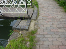
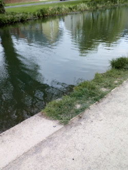
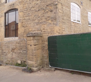
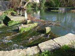
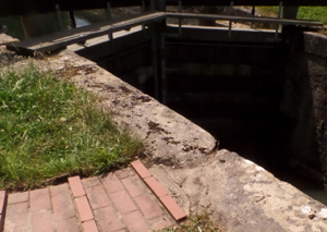
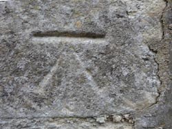
 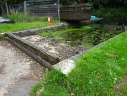 | RHS of slipway, Stroudwater |
| ( 24.0M above sea level) (SO 78456 06081) | |
| streetmap of SO 7846 0606 or | |
| what3words /// grant.signs.survivor | |
| click image to enlarge |
   | Newtown, Roving Bridge |
| ( 28.3M above sea level) (FL BR 178 destroyed) | |
| streetmap of SO 7909 0556 or | |
| what3words /// direction.bathtubs.magazine | |
| click image to enlarge |
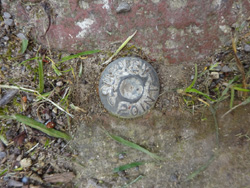
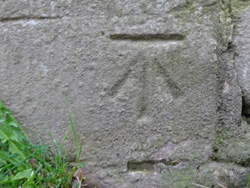
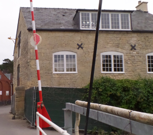
   | Ocean Rail Bridge |
| ( 27.4M above sea level) (says - surveying point) | |
| streetmap of SO 7968 0512 or | |
| what3words /// ambushed.leans.broadcast | |
| click image to enlarge |
   | Stroudwater Ocean Swing Bridge |
| ( 27.49M above sea level) (SO 379812.6-205031.3 , according to surveyor) | |
| streetmap of SO 7981 0504 or | |
| what3words /// fetch.cornfield.able | |
| click image to enlarge |
 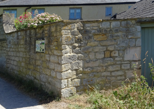   | Nutshell Cottage, Stroudwater |
| ( 27.9M above sea level) | |
| streetmap of SO 8003 0492 or | |
| what3words /// songbird.final.among | |
| click image to enlarge |
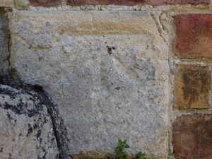    | Nutshell House, at bridge level |
| ( 31.3M above sea level) | |
| streetmap of SO 8005 0492 or | |
| what3words /// rollover.shimmered.engages | |
| click image to enlarge |
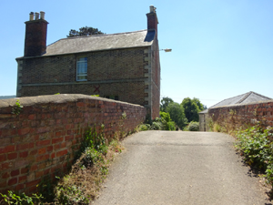
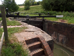
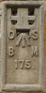  | Skew Bridge, Ryeford |
| ( 27.8M above sea level) (FL BR 175) | |
| streetmap of 70 so80 9304 or | |
| what3words /// refreshed.goose.camper | |
| click image to enlarge |
  | Jacob's Cottage, Stroudwater |
| ( 28.3M above sea level) | |
| streetmap of 66 so81 1504 or | |
| what3words /// turntable.trifle.pampered | |
| click image to enlarge |
    | Ryeford Bridge X2, Ryeford Rd North |
| ( 28.0M above sea level) (FL BR 174 rediscovered) | |
| streetmap of 61 so81 3304 or | |
| what3words /// twirls.plotter.exits | |
| click image to enlarge |
  | Ryeford, pedestrian swing bridge |
| ( 28.0M above sea level) | |
| streetmap of 60 so81 4404 or | |
| what3words /// boom.diamonds.deferring | |
| click image to enlarge |
 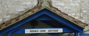 | Double Lock Cottage, Ryeford |
| ( 33.0M above sea level) | |
| streetmap of 60 so81 9204 or | |
| what3words /// templates.quit.quicker | |
| click image to enlarge |
  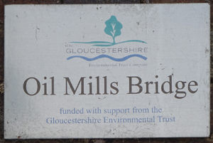 | Oil Mills Bridge, Bridge Rd, Ebley |
| ( 33.3M above sea level) (destroyed) | |
| streetmap of SO 8256 0462 or | |
| what3words /// animates.reviews.peroxide | |
| click image to enlarge |
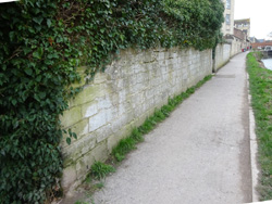
  | canal towpath |
| ( 33.0M above sea level) | |
| streetmap of SO 8274 0462 or | |
| what3words /// wiped.caring.hikes | |
| click image to enlarge |
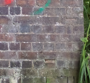
  | Ebley Mill, yard wall end |
| ( 33.4M above sea level) | |
| streetmap of SO 8302 0463 or | |
| what3words /// fastening.speeds.boxer | |
| click image to enlarge |
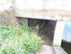
   | Canal weir, into the Frome, Severn River Board pre 1974 |
| ( 33.2M above sea level) | |
| streetmap of SO 8317 0469 or | |
| what3words /// results.song.juicy | |
| click image to enlarge |
   | Lodgemore Mill, building West of road |
| ( 39.1M above sea level) (in private garden) | |
| streetmap of 04 so84 3405 or | |
| what3words /// ruler.thrashing.request | |
| click image to enlarge |
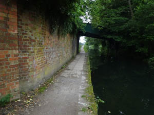
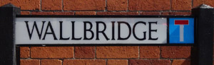
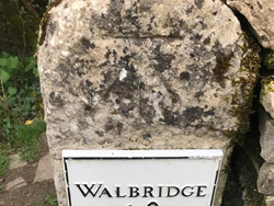
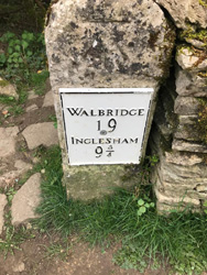
  | arch entrance to towpath, Walbridge |
| ( 38.7M above sea level) | |
| streetmap of 05 so84 5305 or | |
| what3words /// conducted.snuggle.joyously | |
| click image to enlarge |
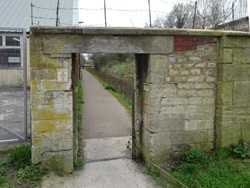
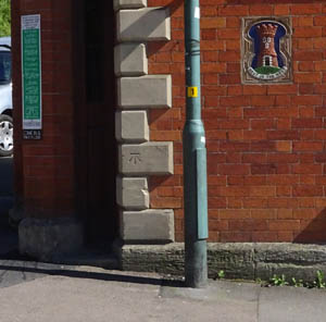
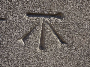
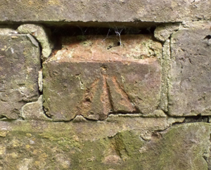
   | Wallbridge, bridge under the bridge |
| ( 41.9M above sea level) (FL BR 170) | |
| streetmap of 08 so84 8405 or | |
| what3words /// reactions.neon.somewhere | |
| click image to enlarge |
   | Bell House, Wallbridge |
| ( 47.7M above sea level) | |
| streetmap of 10 so84 8605 or | |
| what3words /// bulldozer.kinder.stamp | |
| click image to enlarge |
     | Capel's Mill viaduct, buttress, with building inside, X2 |
| ( 43.0M above sea level) | |
| streetmap of 69 so85 3304 or | |
| what3words /// using.arranges.webcams | |
| click image to enlarge |
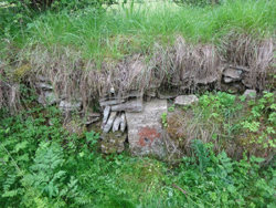
  | sluice, mill pond, nr T&S canal |
| ( 43.3M above sea level) | |
| streetmap of 53 so85 5404 or | |
| what3words /// evolving.sprinting.decanter | |
| click image to enlarge |
  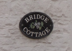 | Bridge Cottage, Butterow, Bowbridge |
| ( 49.3M above sea level) | |
| streetmap of 27 so85 7104 or | |
| what3words /// salon.subsets.decoded | |
| click image to enlarge |
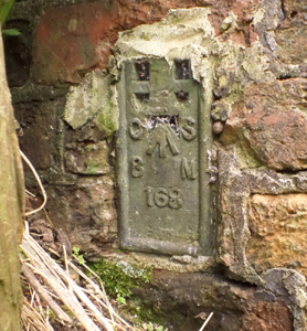   | Stantons Bridge, Thames & Severn Canal |
| ( 47.2M above sea level) (FL BR 168) | |
| streetmap of SO 8585 0396 or | |
| what3words /// prowess.ambushes.investor | |
| click image to enlarge |
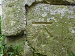
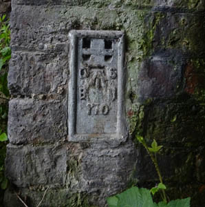
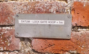
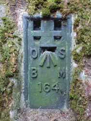
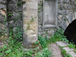
   | Griffin Lock, rivet |
| ( 49.7M above sea level) | |
| streetmap of SO 8586 0365 or | |
| what3words /// flexibly.seated.doll | |
| click image to enlarge |
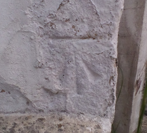
   | Jubilee Bridge. Thames & Severn canal |
| ( 50.6M above sea level) | |
| streetmap of SO 8589 0348 or | |
| what3words /// zaps.additives.shopper | |
| click image to enlarge |
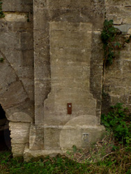
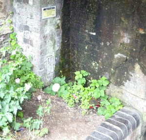
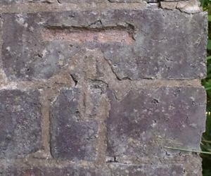
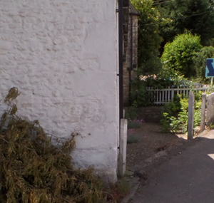
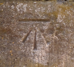
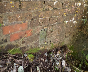
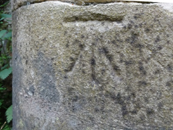
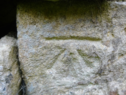
 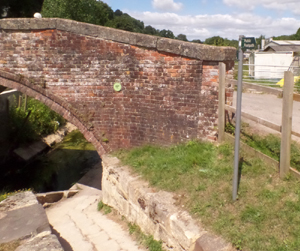 | Ham Mill bridge, modern marker, to replace long lost mark |
| ( 52.9M above sea level) | |
| streetmap of SO 8595 0322 or | |
| what3words /// tonsils.fixtures.throat | |
| click image to enlarge |
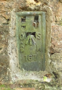    | Thames & Severn Canal, Bagpath bridge |
| ( 53.3M above sea level) (FL BR 167) | |
| streetmap of SO 8606 0295 or | |
| what3words /// cuter.clicker.snug | |
| click image to enlarge |
  | Rail Bridge, Gough's Orchard |
| ( 59.6M above sea level) | |
| streetmap of SO 8653 0243 or | |
| what3words /// chest.deadline.whisker | |
| click image to enlarge |
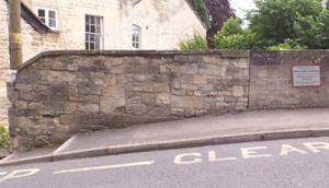
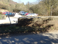
  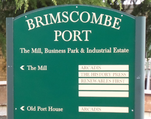 | Brimscombe, Port entrance, opp Ship Inn |
| ( 58.6M above sea level) | |
| streetmap of SO 8680 0234 or | |
| what3words /// cages.unclaimed.luggage | |
| click image to enlarge |
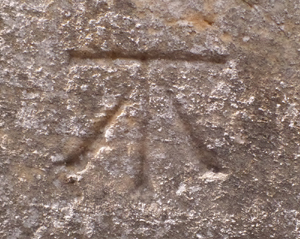 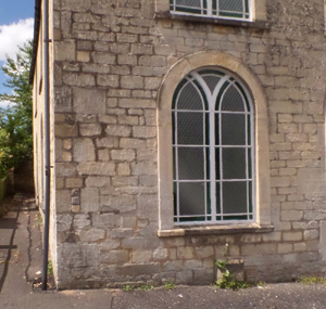 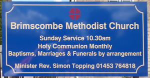 | Brismcombe, Methodist Chapel |
| ( 73.2M above sea level) (uphill from canal) | |
| streetmap of SO 8684 0218 or | |
| what3words /// loser.blogging.tile | |
| click image to enlarge |
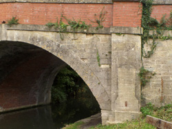
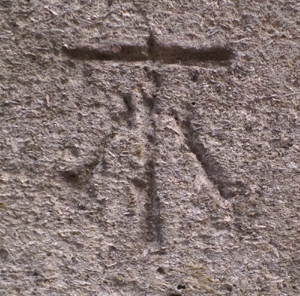   | Brimscombe, railway overbridge |
| ( 69.6M above sea level) (uphill from canal) | |
| streetmap of SO 8686 0221 or | |
| what3words /// arrive.pink.bathtubs | |
| click image to enlarge |
  | Beale's Bridge, hidden in brambles |
| ( 61.2M above sea level) (FL BR 164) | |
| streetmap of SO 8786 0218 or | |
| what3words /// flag.stickler.steroids | |
| click image to enlarge |
  | St Mary's Lock Bridge |
| ( 64.1M above sea level) (FL BR 163) | |
| streetmap of SO 8859 0222 or | |
| what3words /// wrenching.sums.refrained | |
| click image to enlarge |
  | house, Brookside, off London Rd |
| ( 66.7M above sea level) (downhill from canal towpath) | |
| streetmap of SO 8883 0232 or | |
| what3words /// bathtubs.political.hothouse | |
| click image to enlarge |
 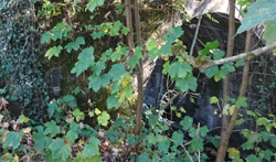 | Clowes Bridge, Thames & Severn Canal |
| ( 77.5M above sea level) (FL BR 161) | |
| streetmap of SO 8993 0249 or | |
| what3words /// rejects.bead.rust | |
| click image to enlarge |
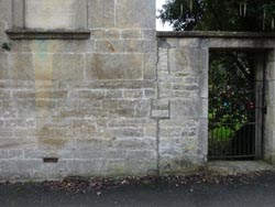
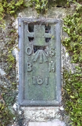
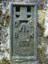
  | road bridge, over canal, Baker's Mill |
| ( 83.9M above sea level) (FL BR 159) | |
| streetmap of SO 9149 0287 or | |
| what3words /// ripen.refills.archduke | |
| click image to enlarge |
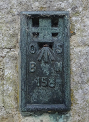  | House, beside the canal, Whitehall |
| ( 93.6M above sea level) (FL BR 158) | |
| streetmap of SO 9233 0298 or | |
| what3words /// pebble.refreshed.years | |
| click image to enlarge |
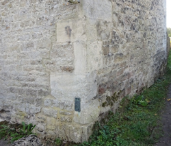
  | Whitehall Bridge, T & S canal |
| ( 93.5M above sea level) | |
| streetmap of SO 9293 0299 or | |
| what3words /// condition.juggler.health | |
| click image to enlarge |
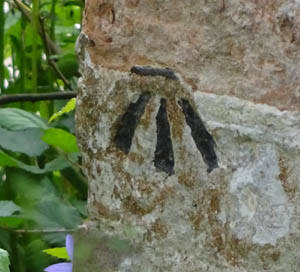
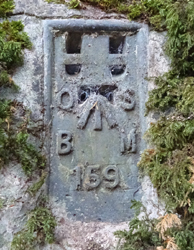
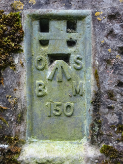
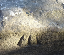  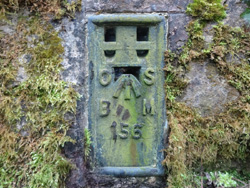  | Daneway bridge X2, rivet, and Flush Bracket |
| ( 112.8M above sea level) (Fl Br 156) | |
| streetmap of SO 9387 0339 or | |
| what3words /// contained.quote.hides | |
| click image to enlarge |
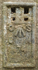
  | Sapperton Tunnel, Coates portal |
| ( 112.6M above sea level) | |
| streetmap of SO 9661 0059 or | |
| what3words /// lend.eagle.hurricane | |
| click image to enlarge |
  | Rail bridge, over Thames & Severn Canal |
| ( 111.5M above sea level) (Fl Br 150) | |
| streetmap of SO 9714 0009 or | |
| what3words /// crispier.cabinets.fans | |
| click image to enlarge |
  | milestone, Coatesfield Quarry |
| ( 111.9M above sea level) | |
| streetmap of SO 9769 0003 or | |
| what3words /// plod.wonderful.persuade | |
| click image to enlarge |
  | milestone, T&S canal, Cerney Wick |
| ( 84.8M above sea level) | |
| streetmap of SU 0763 9651 or | |
| what3words /// seeing.lawfully.monorail | |
| click image to enlarge |
| X | 
|
X |
| ffff | info | |
| < | > |