| : Ordnance Survey Benchmarks that can be observed along : | the MonBrec Canal |
< other canal Benchmarks for copy/paste |
|
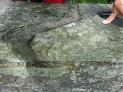
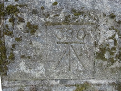
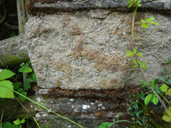
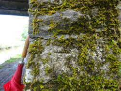
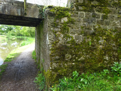
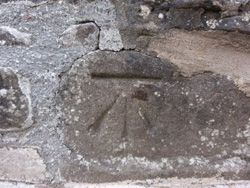
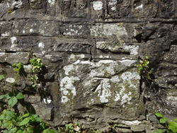
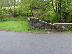
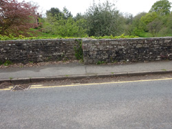
| Bridge parapet, Crumlin Arm |
| ( 85.4M above sea level) | |
| streetmap of ST 2402 9098 or | |
| what3words /// sweeping.weep.endearing | |
| click image to enlarge |
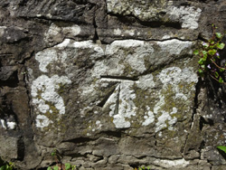
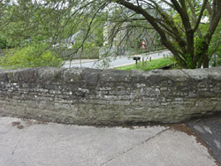
  | MonBrec canal Bridge 50 |
| ( 115.3M above sea level) | |
| streetmap of ST 2927 9944 or | |
| what3words /// looks.impose.shrimp | |
| click image to enlarge |
  | Bridge 55, New Inn |
| ( 115.7M above sea level) | |
| streetmap of SO 2987 0094 or | |
| what3words /// beginning.servers.interval | |
| click image to enlarge |
  | Bridge 63, Croes Y Pant Lane |
| ( 113.0M above sea level) | |
| streetmap of SO 3133 0401 or | |
| what3words /// culling.inner.composer | |
| click image to enlarge |
  | Bridge 74, Saron Rd |
| ( 115.6M above sea level) | |
| streetmap of SO 3142 0580 or | |
| what3words /// deeper.spends.table | |
| click image to enlarge |
  | Old Abergavenny Rd Bridge |
| ( 116.8M above sea level) | |
| streetmap of SO 3138 0726 or | |
| what3words /// computer.decorator.target | |
| click image to enlarge |
  | Ochram Turn Bridge No 86 |
| ( 112.8M above sea level) | |
| streetmap of SO 2985 0926 or | |
| what3words /// wired.passively.vertical | |
| click image to enlarge |
  | Poplar Bridge 87 |
| ( 113.2M above sea level) | |
| streetmap of SO 3004 0941 or | |
| what3words /// farmed.signs.minute | |
| click image to enlarge |
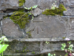
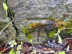
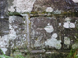
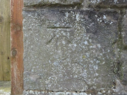
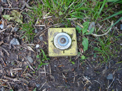  | modern survey rivet |
| ( 79.7M above sea level) | |
| streetmap of SO 2799 1385 or | |
| what3words /// baking.repeating.riddle | |
| click image to enlarge |
  | Station Road Bridge No 98 |
| ( 115.7M above sea level) | |
| streetmap of SO 2658 1372 or | |
| what3words /// satin.driveways.widgets | |
| click image to enlarge |
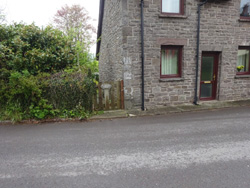
  | Govilon Aqueduct No 10, under canal |
| ( 108.1M above sea level) | |
| streetmap of SO 2638 1384 or | |
| what3words /// lectures.cleanest.pylon | |
| click image to enlarge |
  | Ty - Gwynn Bridge No 102 |
| ( 115.7M above sea level) | |
| streetmap of SO 2536 1452 or | |
| what3words /// remove.react.mild | |
| click image to enlarge |
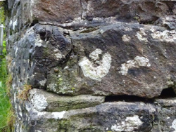
  | Pont Llangatwg |
| ( 114.4M above sea level) | |
| streetmap of SO 2070 1777 or | |
| what3words /// forwarded.serious.youngest | |
| click image to enlarge |
  | ex Kings Arms, up from canal |
| ( 115.7M above sea level) | |
| streetmap of SO 1686 1948 or | |
| what3words /// spark.obviously.recruited | |
| click image to enlarge |
 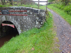 | South portal of Ashford tunnel |
| ( 129.5M above sea level) | |
| streetmap of SO 1241 2144 or | |
| what3words /// damp.rock.sheds | |
| click image to enlarge |
  | North portal of Ashford tunnel |
| ( 131.2M above sea level) | |
| streetmap of SO 1226 2175 or | |
| what3words /// tweed.lighters.tries | |
| click image to enlarge |
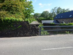
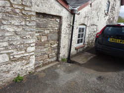
  | Cottage on main road |
| ( 123.9M above sea level) | |
| streetmap of SO 0925 2505 or | |
| what3words /// stir.reject.ripe | |
| click image to enlarge |
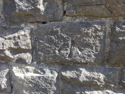
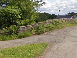
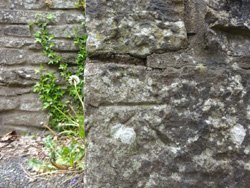  | Lock Bridge, road over the Usk |
| ( 128.5M above sea level) | |
| streetmap of SO 0773 2725 or | |
| what3words /// mercy.fevered.pacifist | |
| click image to enlarge |
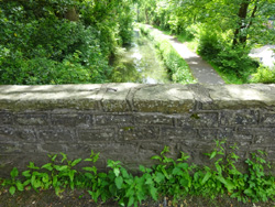
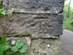
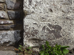
  | Bridge parapet |
| ( 135.1M above sea level) | |
| streetmap of SO 0518 2801 or | |
| what3words /// booms.weeknight.exams | |
| click image to enlarge |
| X | 
|
X |
| ffff | info | |
| < | > |